In the fall of 2015 we toured some of the most famous canyons in the world. It was a long-planned but long-delayed trip that finally came about October 25 through November 9, 2015.
Canyon de Chelley National Monument
After a day and half of driving from Austin, we began by visiting Canyon de Chelly National Monument in northeastern Arizona. Pronounced "de SHAY", this group of three canyons on ancient Navajo lands is still home to many of the tribe. It is famous (or infamous) as the last refuge of the Navajo before being removed to Bosque Redondo near Fort Sumner, New Mexico. Click here to view some of the sites in the canyon.
Capitol Reef National Park
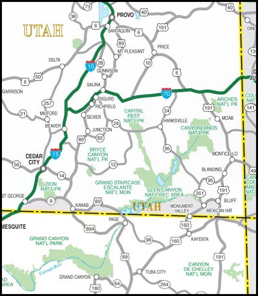
A few hours northwest of Canyon de Chelly in south-central Utah is Capitol Reef National Park. It is bisected by Utah Highway 24 and is served by the small town of Torrey on the west side if the park. The park's main geological feature is the Waterpocket Fold, a monocline that extends about 75 miles through the park and south toward Lake Powell. The upper sediments of the moncline were eroded away to expose the so-called reef formations of the Navajo Sandstone. Erosion resulted in spectacular frormations of white and red sandstone cliffs, canyons, arches and monoliths that together presented a barrier to east-west travel for the pioneers. Click here to view photos.
Grand Staircase-Escalante National Monument
The area generally south of Capitol Reef is the Grand Staircase-Escalante National Monument, and Utah Highway 12 cuts through it from Torrey, through Boulder, Escalante and on to Bryce Canyon. The name Grand Staircase comes from the regional geology that resembles (to geologists) a staircase in time from the older sediments at the Grand Canyon up to younger sediments toward Boulder. It has an extensive collection of slot canyons. Click here to see a few photos from the area, especially of the Burr Canyon east of Boulder.
Bryce Canyon National Park
A few hours southwest of Capitol Reef is Bryce Canyon. This park, though not large, is famous for its spectacular hoo-doos, and yielding perhaps some of the most iconic Utah photos. The Claron formation, a limestone/shale deposit of earlyTertiary age (40 to 66 million years ago), has been, and continues to be, eroded to form the red/pink/white hoo doos. Click here to view photos.
Zion National Park
A few hours southwest of Bryce is what most people consider the gem of Utah’s national parks, Zion. It is indeed an amazing place with huge, towering cliffs, stark peaks, beautiful canyons and rivers and streams — a wonderful place to hike and photograph. The geology is dominated by red and white cliffs, mainly Navajo and Chinle sandstones but there are other strata exposed as well. Click here to view the Zion page.
Grand Canyon National Park
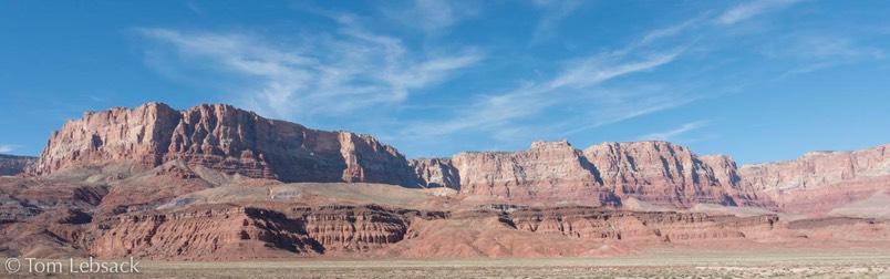
The Grand Canyon lies south of Zion and takes several hours to drive there. On the way the scenery is pretty amazing, especially along the Vermillion Cliffs (photo at the right). As you get closer to the park (in our case, the South Rim), you leave the barren desert environment, the elevation increases to over 7000 feet and pine trees become more prevalent.
The Grand Canyon, one of the true wonders of the world, is absolutely huge, extending a mile deep (from the North Rim) and 277 miles in length along the river. To paraphrase Teddy Roosevelt, “A place every American should see.” Click here for photos.